Overview
Timmons Group provided survey services for the Springhill subdivision, a 127-acre residential development in Lillington, North Carolina. As part of the project, the developer needed to locate two existing waterlines connected to nearby water towers. Our Ground Penetrating Radar (GPR) team mobilized from Richmond to conduct a subsurface scan of the area.
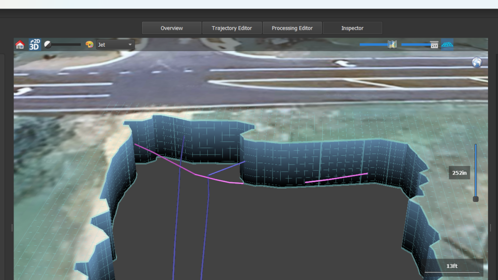
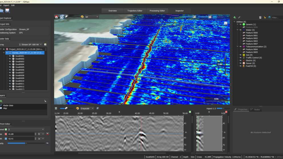
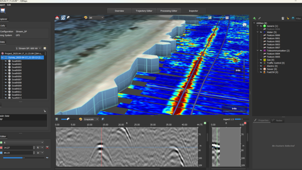
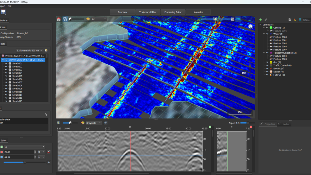
Using advanced GPR scanning technology, our team successfully identified the precise location of the underground water lines. Once fieldwork was complete, the team processed the data using IQMaps software to identify and map underground utility signatures, which were then exported into CAD and GIS formats for integration into the overall site planning. This approach allowed the project to meet ASCE 38-22 Quality Level B standards for subsurface utility investigations. This data was then delivered to our Raleigh-based survey group, who completed Quality Level A test pits to confirm utility placement.
Survey services for the project included control and boundary surveys, ALTA/NSPS Land Title Survey, aerial topographic mapping, sanitary sewer surveying, and underground utility location. Timmons Group’s ability to combine subsurface utility engineering with traditional survey methods ensured a smooth start to the site’s development process.