Overview
Apple Branch Watershed Study as a Catalyst for Congressional Investment
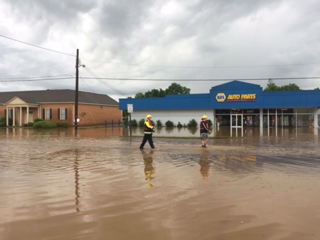
In 2021, the City of Danville partnered with Timmons Group to conduct a comprehensive engineering study of the Apple Branch watershed, funded through the Virginia Department of Emergency Management’s Pre-Disaster Mitigation Grant Program (75% grant, 25% City match). The study focused on flooding concerns from Apollo Drive downstream to the Dan River, an area cover approximately 2.1 square miles above Riverside Drive.
The project included development and calibration of hydrologic (HEC-HMS, PCSWMM) and hydraulic models (HEC-RAS 1D/2D) for multiple storm events (2-, 10-, 25-, 50-, 100-, and 500-year) and short-duration high-intensity storms, using Hurricane Michael high-water marks for calibration. Field data collection included topographic surveys, SUE investigations, and morphological assessments, supplemented by Doppler rainfall analysis. Existing system capacity was quantified through SWMM modeling, and conceptual mitigation alternatives were evaluated for protection of adjacent structures and critical intersections such as Audubon and Riverside Drive.
Recommendations incorporated nature-based solutions, including floodplain conversion to parkland and proposed flood walls, while considering property constraints and easement limitations. The study served as supporting documentation for FEMA funding and informed the City of Danville’s successful application for Congressionally Directed Spending in FY23, securing federal investment to implement critical flood mitigation improvements.
Funding: FEMA & Congressional allocation