Overview
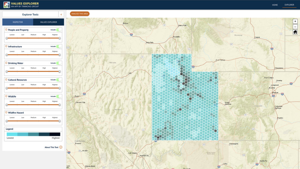
The Values Explorer is a planning tool designed to aid in prioritizing projects (whether those projects are hazardous fuels reduction, wildfire mitigation, conservation, development, or any other type of project). Users can do multi-scale planning (from the national level down to the community level) by allowing the user to view the density and distribution of highly valued resources and assets (HVRAs), critical habitat, or other valued resources in the user’s area of interest. The Values Explorer solution can be quickly stood up as a cloud service and provisioned to use a client’s specified GIS data. Timmons Group will work with you to identify and process the desired data to work with our Values Explorer solution.
Potential uses include:
- Hazardous fuels reduction planning
- Highly Valued Resources and Assets (HVRA) analysis
- Statewide Wildlife Action Plan (SWAP) mapping and analysis
- Crucial Habitat Planning
- Wildfire Mitigation Project Planning
- Statewide funding distribution decision-making
- Much more…
Features of this Solution:
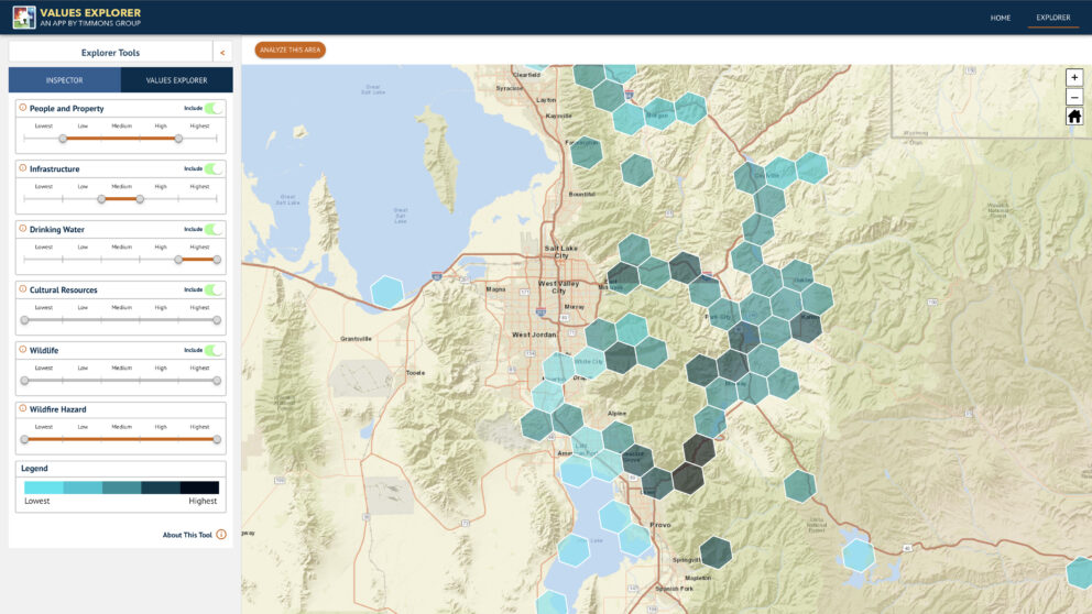
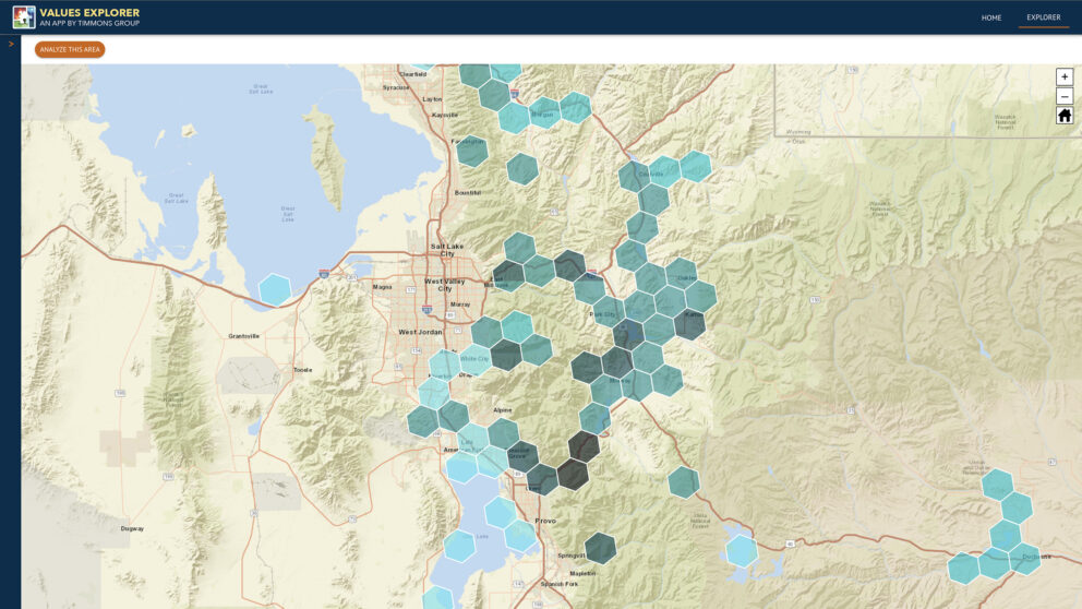
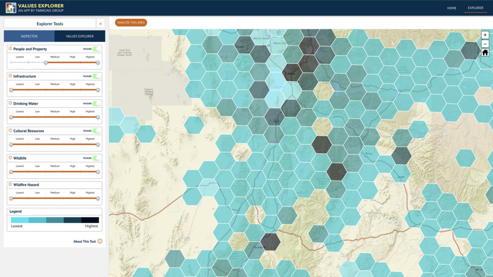
- Multiple scales (zoom levels) of hexagon-based planning units for easy planning and analysis (national, regional, state, jurisdictional, county, city and community level).
- Ability to include any number of geospatial layers and datasets as “Values” to stamp on hexagon-based planning units.
- Ability to update underlying geospatial layers and datasets as additional data or changes become available.
- Ability to group “Values” and quickly filter areas on the map based on the density of resources (low, medium, high) that make up that “Value”.
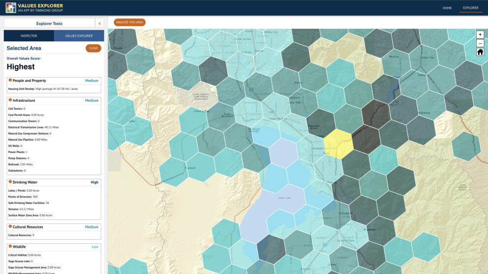
- “Analyze this Area” tool which creates a thematic map for the user’s defined extent based only on the values and resources within that extent.
- Ability to exclude values and re-render the thematic map of resource density and priorities.
- Ability to drill into any hexagon on the map and identify all resources (across multiple geospatial layers) that are stamped on that hexagon.