Understanding what’s beneath the surface is essential to delivering safe, efficient, and informed project development. At Timmons Group, we’re expanding our capabilities in Subsurface Utility Engineering (SUE) with the addition of Ground Penetrating Radar (GPR), a non-destructive geophysical method used to image and interpret underground features.
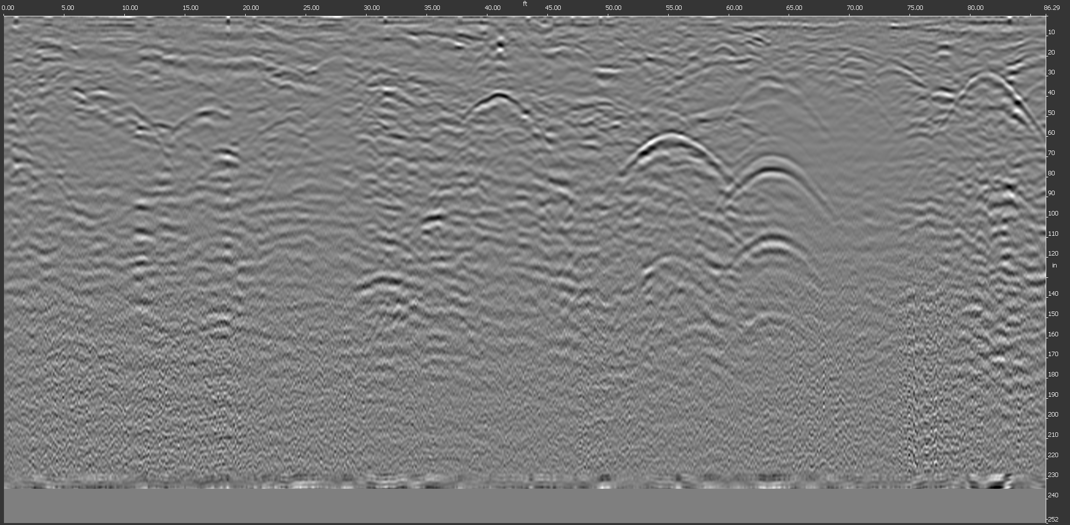
GPR uses high-frequency electromagnetic pulses that travel into the ground and reflect back when they encounter buried anomalies, such as utility lines or other subsurface materials. These reflections are captured and processed to create a visual representation of what lies below the surface.

How Does It Work?
Our team uses a multi-channel ground penetrating radar (MCGPR) unit known as the STREAM DP, engineered by IDS GeoRadar, a Hexagon company. The system includes 30 channels (19 vertical and 11 horizontal) and features a 3-foot-wide antenna array that allows for efficient, high-density data collection across large areas.
What makes the STREAM DP unique is its patented EsT technology, which significantly enhances depth penetration by 40% to 60% over standard GPR systems. This gives our teams a clearer picture of subsurface conditions at greater depths.
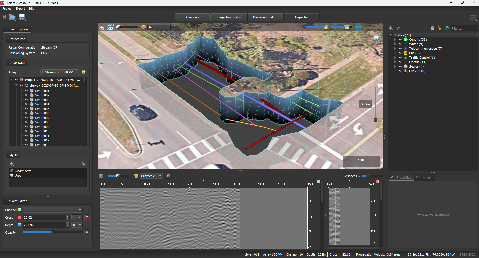
In the field, we collect data using uMap software and pair the system with either RTK GPS or a robotic total station to provide a fixed position. Once the data is collected, it’s processed in IQMaps software, where utility features appear as distinctive “upside-down U” shapes. These features are then interpreted, designated, and exported into CAD or GIS formats for use in design, documentation, or further analysis.
Why Use GPR?
GPR provides several advantages for utility locating and subsurface investigations, especially in environments where traditional locating methods may be limited. Some of the key benefits include:
- Locating nonconductive utilities, such as PVC, concrete, or clay pipes, that may not respond to electromagnetic detection.
- 2D and 3D utility visualization, which supports clear documentation and informed design decisions.
- Enhanced collaboration with our SUE vacuum excavation team by identifying precise dig locations.
- Application across multiple disciplines, including utility mapping, environmental assessments, and geospatial data collection.
Supporting Smarter Decisions Below the Surface
The Federal Highway Administration (FHWA) recognizes and highly endorses the value of GPR and 3D utility mapping for reducing utility strikes and project costs. With recent advancements in multi-channel technology, GPR can now be used to support ASCE 38-22 Quality Level B utility designations.

As a new addition to our suite of SUE services, GPR helps strengthen our ability to deliver accurate, actionable subsurface utility data to our clients. By combining innovative tools with industry best practices, we’re helping project teams better understand their underground environment to support successful project outcomes before the first shovel hits the ground.
Ready to get started? Contact our team to see how GPR can enhance your project’s deliverables.

