Overview
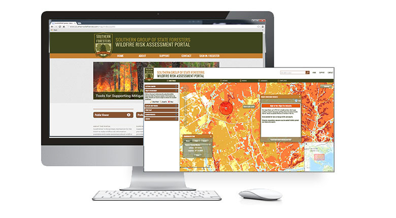
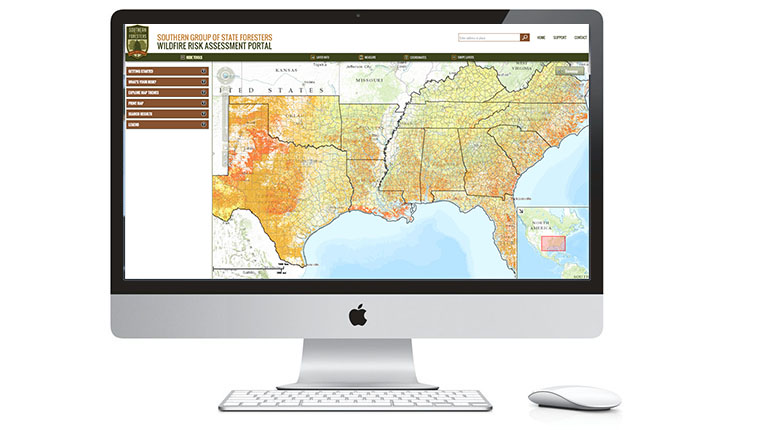
Building upon the success of the Texas A&M Forest Service TxWRAP web portal, the Southern Group of State Foresters (SGSF) has invested in the development of the Southern Wildfire Risk Assessment Portal, SouthWRAP, to provide similar web mapping capabilities for the other 12 Southern states. The intent is to make the Southern Wildfire Risk Assessment results readily accessible to the public and professional planners for awareness, education and mitigation planning purposes. Like TxWRAP, this portal provides access to a suite of web mapping applications that facilitate access to wildfire risk information for the public and professional planners.
In addition to the standard Public Viewer application and the Professional Viewer application, SouthWRAP also has a new Communities-at-Risk Editor application, called CARE. This app supports local foresters for each SGSF state agency with defining wildland community boundaries using a newly developed 2012 WUI layer. The WUI layer has been developed for the entire South based on methods defined in the 2010 Kentucky Communities Updating Pilot Project.
With CARE, local agency foresters will not only be able to accurately define wildland communities and name them to build an up-to-date south-wide repository, but can also use the SWRA risk data to derive risk ratings for each community. With CARE, the SGSF will have the most comprehensive and accurate definition of communities-at-risk in the Nation
The Live Site : http://www.southernwildfirerisk.com/
We’ve created the demo video below to introduce the site’s Public Viewer, offering a beginner’s tool to navigating the portal.
SouthWRAP – Educating Communites on Wildfire Risk from Timmons Group on Vimeo.
FEATURES
• SGSF Public Viewer app
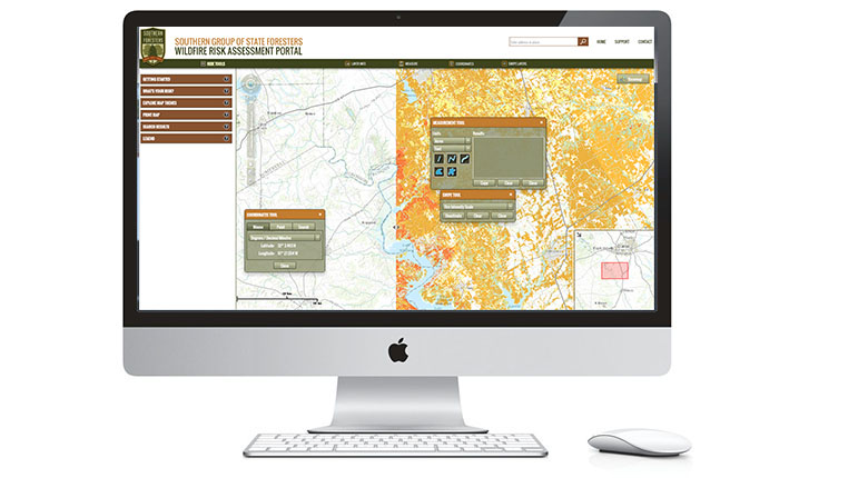
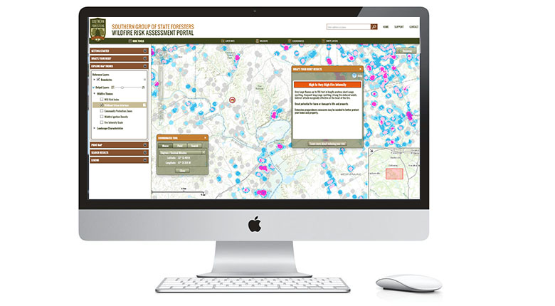
• Professional Viewer app with detailed risk summary reporting & data export tools available for individual states
• Includes data for 12 Southern states
• Incorporates new 2012 WUI data
• Includes Communities-at-Risk Editor (CARE) app to aid local agency foresters in defining wildland communities and defining their risk ratings
For more information on this project, contact Lowell Ballard.