

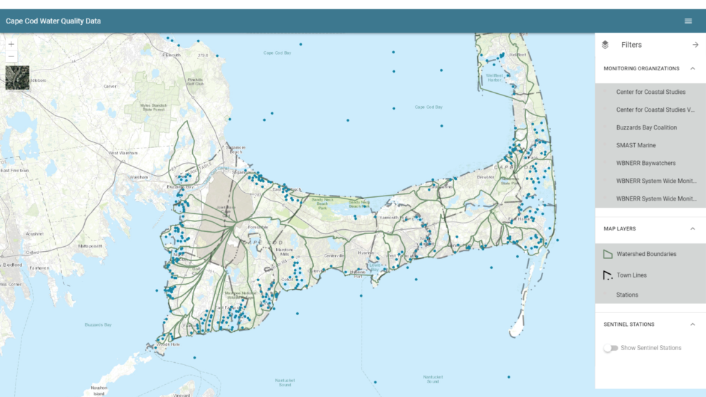
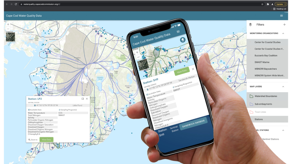

Overview
The Cape Cod Commission (CCC) and its partners needed a user-friendly, web-based portal to share water quality data and analyses with municipalities, organizations, and the public. The CCC desired the portal to be the centralized location for its partners and the public to regularly access updated data from monitoring sites on a map and view water quality trends via intuitive visualizations to support collaboration and timely data sharing.
Timmons Group developed a Microsoft cloud Azure-based web-mapping application that consumes data hosted by KISTERS Water Information Systems (WISKI) database and application programming interface (API). The application consumes water quality data input from regional partners via an API and presents it on a map for analysis using dynamic data visualization JavaScript libraries. The application uses several Esri components including the ArcGIS API for JavaScript v4.x, ArcGIS Enterprise, and ArcGIS Online basemap services in order to streamline the development.
The Cape Cod Water Quality Data Portal allows users to explore marine water quality data aggregated from our regional partners and to depict high-level temporal trends in water quality parameters by monitoring site or embayment. The shared data aggregation and visualization effort are helping regional water quality efforts throughout Cape Cod and provide a one-stop location for data, resulting in saved time and effort by all project partners. The development of the collaborative data-sharing portal enables data insights and proactive insights into water quality data.