

Overview
The Tualatin Soil and Water Conservation District (TSWCD) experienced rapid growth in a short period of time and many of the existing systems could not keep pace with the changing demands of the organization. Many processes relied heavily on manually created documents and limited database applications not integrated with GIS and based on legacy technology. TSWCD desired to implement a new technology solution to enable prioritization, planning, tracking, and reporting of conservation work in the Washington County community.
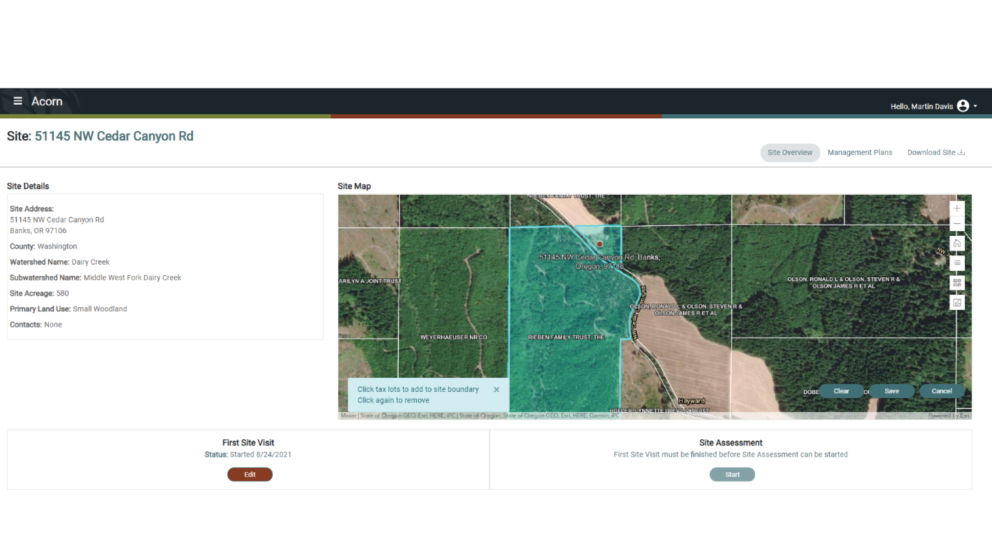
Timmons Group worked with TSWCD to develop a web-based mapping application called Acorn that integrates with a Client Relationship Management (CRM) program. Together the systems allow TSWCD staff to better plan and track projects and provide a previously missing spatial component.
Acorn allows all TSWCD staff members to have increased access and transparency to information during all phases of a project life cycle. Users within TSWCD now utilize a standard workflow for managing projects, have increased data consistency, and can more reliably and accurately project where to work and provide metrics and reports to the public. Ultimately, staff can now more efficiently serve the residents of Washington County and the Tualatin River watershed.