
Overview
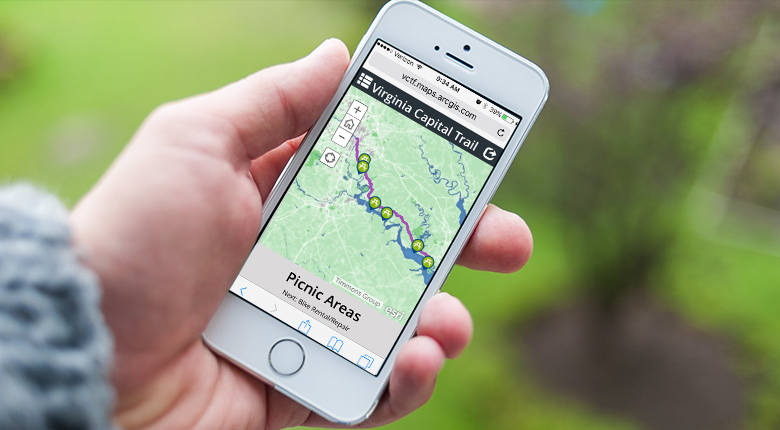
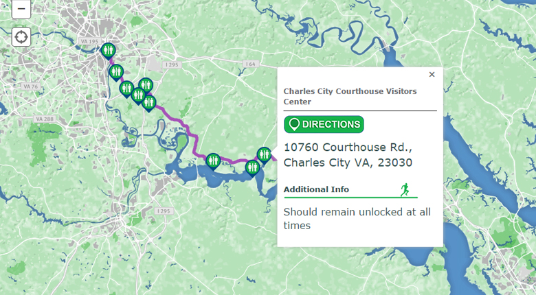
The Virginia Capital Trails map will provide resources for bikers, runners, and nature lovers to view the trail and its amenities along the 52-mile course. The Virginia Capital Trail will connect historic Jamestown in Williamsburg to downtown Richmond.
Timmons Group designed the new web map using Esri technologies. The VCT map will be a digital view of the trail that will reveal what is ahead with icons clearly identifying specific points along the trail, which includes restrooms, picnic areas, and parking availability. Status updates of open and closed portions of the trail are also available for users.
“Being an active participator in the community, we were elated that the Virginia Capital Trail Foundation chose us to develop this map”, said Chris Gerecke, Director of Enterprise Solutions. “Being able to contribute to both the physical and digital development processes for this initiative has been a truly rewarding experience.”
In addition to their role in the digital application, Timmons Group’s transportation division has also provided trail planning, design, and landscape architecture services for the Varina phase of the trail.
To access the application, visit http://virginiacapitaltrail.org/trail/map/.