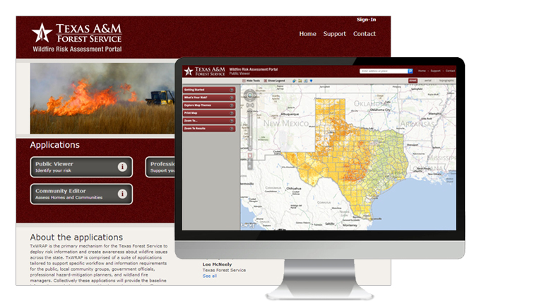
Overview
Working collaboratively with our friends at the Texas A&M Forest Service, Timmons Group has developed an internet-based wildfire risk information portal called TxWRAP (Texas Wildfire Risk Assessment Portal).The primary focus of TxWRAP is to make wildfire risk information and planning tools readily available to the public, Texas state agencies, local governments, and other stake holders in a timely and efficient manner.
TxWRAP is the primary mechanism for the Texas A&M Forest Service to deploy risk information and create awareness about wildfire issues across the state. TxWRAP is comprised of a suite of web-mapping applications tailored to support specific workflow and information requirements for the public, local community groups, government officials, professional hazard-mitigation planners, and wildland fire managers. Collectively these applications will provide the baseline information needed to support mitigation and prevention efforts across the state.
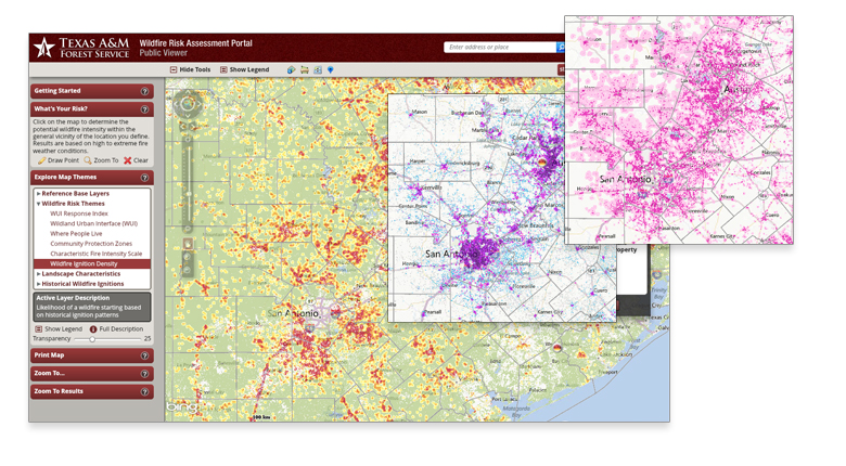
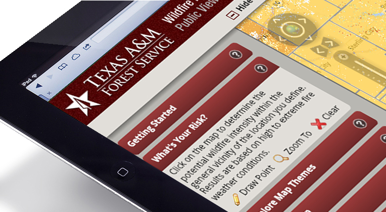
Public Viewer –“Identify Your Risk”
Designed to let users zoom to a place of interest, explore map themes and identify wildfire risk for a specific location on the map. The featured tool in this application is called “What’s Your Risk?”. It allows users to identify specific risk levels within a 2-mile radius of a home, or any other point of interest on the map, and provides a link to additional resources for users wanting to know how to reduce their risk.
Professional Viewer –“Support Your Fire Protection Plans”
Designed to support the community wildfire protection planning needs of government officials, hazard-mitigation planners and wildland fire professionals. This application contains advanced functionality and additional map themes as compared to the Public Viewer. The key features of this application include the capability to define a project area, generate a detailed risk summary report, and export and download wildfire risk GIS data. Additional applications and tools are available to support task specific requirements.
For more information about the project please contact Lowell Ballard.
View the live site: http://www.texaswildfirerisk.com

FEATURES
• 2010 Texas Wildfire Risk data
• Apps for:
– Public Viewing
– Professional Mitigation Planning
– Community & Home Assessment
– Fire Occurrence Explorer
• Works on mobile devices
• Map printing
• Define project areas
• Detailed risk summary reporting
• Export & download GIS data
• Public “What’s Your Risk?” tool