Overview
Timmons Group was asked to assist the Virginia Department of Forestry (VDOF) in building and implementing a geospatially enabled enterprise information system called the Integrated Forest Resource Information System (IFRIS).
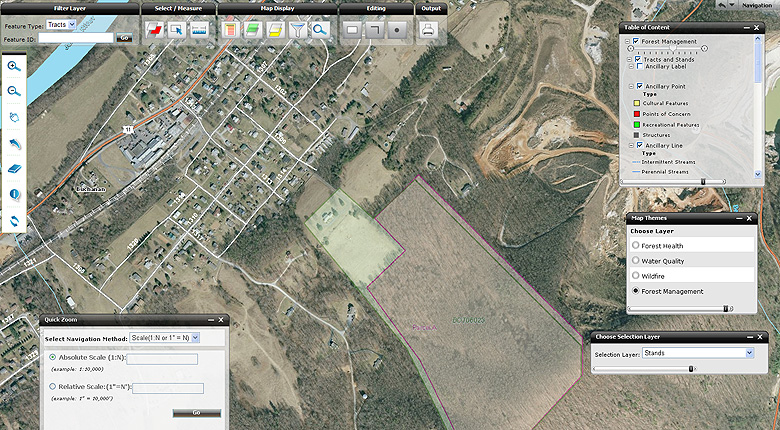
The first phase of the implementation was deployed in 2006 and allows users to spatially and temporally track activities and quantify time spent in terms of strategic goals, grant allocation, and cost sharing. As part of the initial consulting services, Timmons Group assisted VDOF in the development of a supporting needs assessment and information architecture solution. The needs assessment and initial due-diligence was accomplished through user interviews, information collection, legacy application and data review. User interviews included a diverse set of users ranging from technical staff to foresters and field professionals. The developed solution includes the use of Esri’s ArcGIS Server© and ArcSDE© to meet spatial data management, reporting and analysis. The architecture is extensible and offers geospatial web services as part of a service oriented architecture (SOA) model.
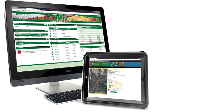
For the second phase, VDOF needed to extend its investment in an enterprise GIS to the field and allow remote field-workers to access business and geographic functions needed for daily routines. Specifically, we needed to design an enterprise GIS application that allowed employees to track time, accomplishments, and map forest-related activities out in the field.
VDOF’s IFRIS Mobile solution integrates GPS functionality, allowing staff to use Esri’s ArcGIS Server and ArcGIS Mobile software. All field workers are equipped with Trimble GeoXMs running ArcGIS Mobile, SQL Server Compact, and .NET Compact Framework 2.0. Field employees use the GeoXM device to collect feature data by cataloging attributes on an inventory form along with GPS coordinates. GIS Web services push the GPS data and associated attributes from the mobile device to IFRIS Web.
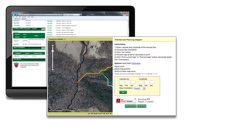
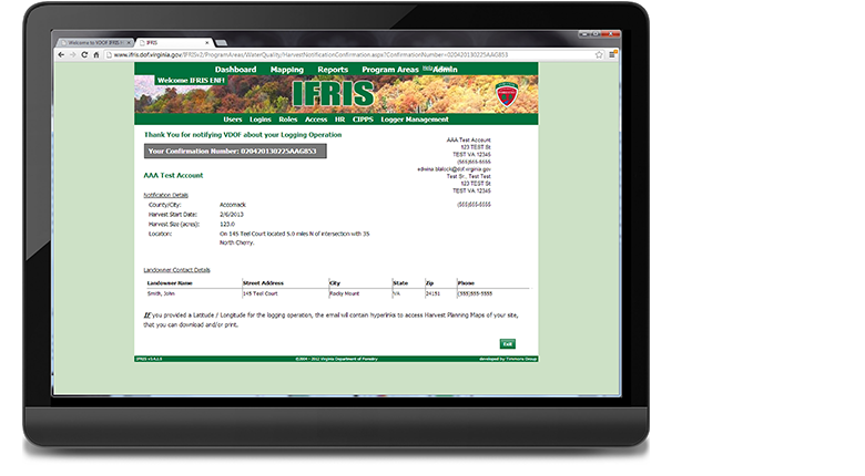
Utilizing the seamless synchronization capabilities provided by ArcGIS Mobile to ArcGIS Server, mobile workers can easily log every phase of the inspection process in the field while also recording timesheet information and monitoring observations and inspections that they recently completed.