Overview

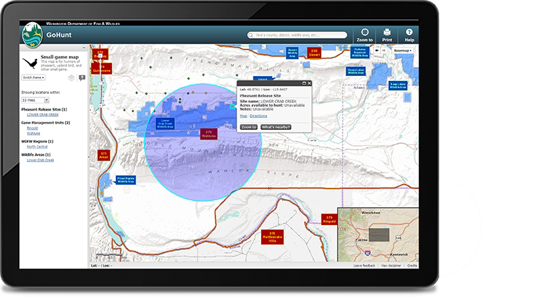
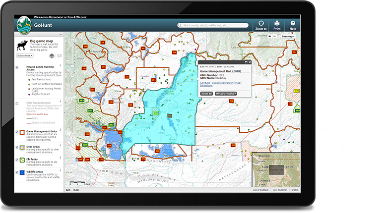
The GoHunt web application allows users to accessvaluable information relating to their hunting strategies. Users have the ability to obtain information utilizing the interactive map of the entire state. It allows users to locate specific production areas, hunting areas, and harveststatistics throughout the state.
Features:
Interactive Map –Users can utilize a revamped and intuitive interactive mapping application
Map Themes –Several focused map configurations were created to focus the user experience to topics of interest, such as big game, small game, and waterfowl
Search –By implementing a single search field that auto-completes the user’s query as they type, we were able to eliminate the need for complex search forms
What’s Nearby –We added the “what’s nearby” feature, to allow users to find production areas and private hunting lands within a customizable buffer
Zoom To My Location – “My Location” offers the capability to enter GPS coordinates and zoom the map to a particular location of interest
Print – Users can print or save as a digital pdf