Overview
Horry County, South Carolina selected Timmons Group to provide emergency management application upgrades and to provide new applications for emergency management and operations.
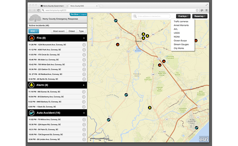
Timmons Group provided upgrades to the County’s Integrated Regional Information Sharing System (iRISS), including new role based authentication, Flex API widget development, and Esri programming integration support. Specific tasks included integrating the County’s Motorola 911 Dispatch system feeds for fire and rescue, adding archival views, earthquake tracking, integration of USGS MODIS events, real-time plume modeling, and WebEOC integration.
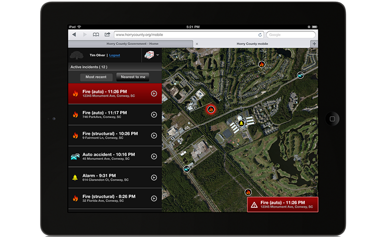
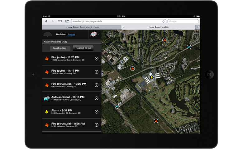
Timmons Group also built an iPad-based emergency management “dashboard” for the County’s emergency operations division. The dashboard is built using HTML5, making the dashboard a field tool as well as a desktop viewer for the emergency operations center. New incidents and alerts are pushed to the application, and geoprocessing tools are used to gather and display the pertinent information a first responder would need, depending on the incident. The geoprocessing tools produce a buffer surrounding the incident, and automatically display all relevant geographic data, such as displaying the closest on-duty officers, hospital, hydrants, shelters, traffic cameras, etc.